Deep Depression in Bay of Bengal; West Bengal to See Scattered to Heavy Rains, Fishermen Warned Till Friday

IIE DIGITAL DESK : The depression has formed over the Bay of Bengal and is expected to move ashore via north Andhra Pradesh and south Odisha by Tuesday afternoon. Meteorological authorities say the system will not directly strike West Bengal, but its peripheral effects will influence the state’s weather through the week, bringing spells of thunder, gusty winds and varying rainfall amounts across districts. Sea conditions are likely to remain rough, and an advisory banning fishing activity has been issued until Friday.
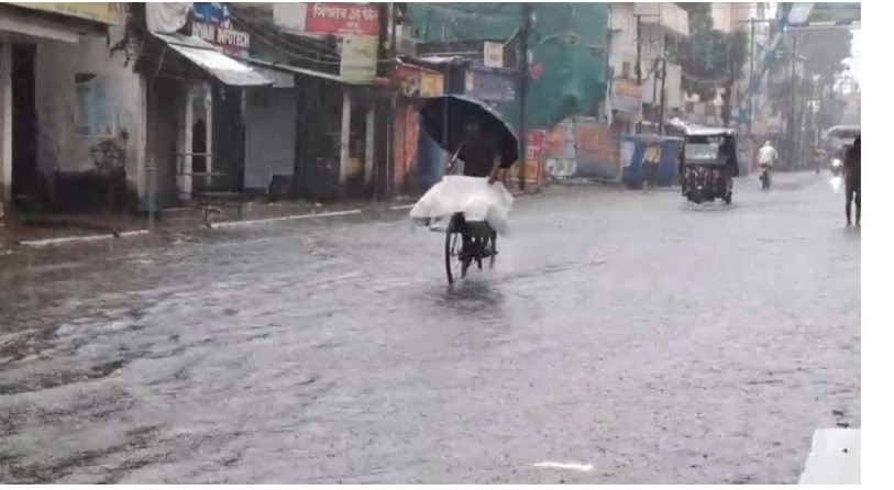
Southern Bengal will feel the system’s influence first: Tuesday and Wednesday are likely to bring scattered moderate rains with thunder and blustery winds in Kolkata and most southern districts, while rainfall will intensify from Thursday in South 24 Parganas. By Friday, heavy showers are forecast in parts of East Burdwan, Murshidabad, Nadia, North and South 24 Parganas and East Medinipur. Saturday’s outlook points to heavy rain over the two 24 Parganas, East and West Medinipur, Howrah and Jhargram, and Sunday could see increased precipitation over East and West Medinipur, Jhargram, Purulia and Bankura. The weather office flags South 24 Parganas as the district likely to receive the highest totals this period, possibly accumulating 150–175 millimetres of rain, with Kolkata also receiving substantial rainfall.
North Bengal will not be spared entirely. The plains and hill districts are expected to witness thunderous rain accompanied by strong winds of 30–40 km/h, with the higher rainfall probability concentrated in the five northern hill districts. Rainfall is likely to rise from Wednesday, with Jalpaiguri, Alipurduar and Kalimpong facing heavier downpours on Thursday and Friday; weekend rainfall there should taper off. Mariners and coastal communities are being alerted to the agitated sea state for several days.
Authorities have already issued precautionary guidance: fishing operations are restricted until Friday and coastal monitoring will remain active as the system approaches the coast. Residents in low-lying and flood-prone pockets are advised to stay alert for sudden increases in water levels and local advisories from district administrations. While the depression is not predicted to make a direct landfall in West Bengal, its indirect impacts over the coming days could disrupt travel, agriculture and coastal livelihoods, and call for continued vigilance.
You might also like!