Red Alert in Andhra Pradesh and Odisha as Cyclone Akvan Intensifies; Heavy Rain Expected in Gangetic West Bengal

IIE DIGITAL DESK ; November 19: The Cyclone Akvan steadily gaining strength over the Bay of Bengal, several eastern and southern coastal regions are bracing for severe weather conditions. The India Meteorological Department (IMD) has issued a red alert for coastal Andhra Pradesh and Odisha, warning of heavy to extremely heavy rainfall over the next two days. Meanwhile, the impact of the approaching cyclone is also being felt in West Bengal, where rainfall has already started in several areas, raising concerns over possible waterlogging and adverse weather conditions.
The latest weather forecast, Cyclone Akvan is expected to intensify into a severe cyclonic storm and cross the coasts of north Andhra Pradesh, Yanam and southern Odisha on Friday, November 20. The approaching weather system is likely to bring intense rainfall, strong winds and rough sea conditions across the affected coastal districts. Considering the potential danger, the authorities have advised fishermen not to venture into the west-central and north-western Bay of Bengal until November 21.
The IMD has warned that coastal districts of Andhra Pradesh and Odisha could experience heavy to extremely heavy rainfall during the next 48 hours. The red alert indicates the possibility of severe weather conditions that could disrupt normal life, damage infrastructure and create difficulties for people living in vulnerable coastal areas. Residents have been advised to remain alert and follow instructions issued by local administrations and disaster management authorities.
The influence of Cyclone Akvan is not limited to Andhra Pradesh and Odisha. West Bengal is also likely to experience significant changes in weather conditions due to the indirect impact of the cyclone. Rainfall began across parts of the state on Thursday morning, bringing a sudden change in the weather. According to the meteorological department, Gangetic West Bengal could witness heavy rainfall accompanied by thunderstorms over the next two to three days.
Several districts in southern Bengal may experience intermittent showers, lightning and gusty winds as the weather system influences atmospheric conditions over the region. The possibility of localised heavy rainfall has also raised concerns about temporary waterlogging in low-lying areas. Residents have been advised to remain cautious, particularly during periods of thunderstorms and strong winds.
The impact of the weather system is also expected to extend towards northeastern India. The IMD has forecast heavy rainfall accompanied by thunderstorms in several parts of the northeastern region over the next few days. The Andaman and Nicobar Islands are also likely to experience thunderstorms, rainfall and gusty winds during the next 48 hours. Sea conditions in the surrounding waters may remain unfavourable, making fishing and other maritime activities risky.
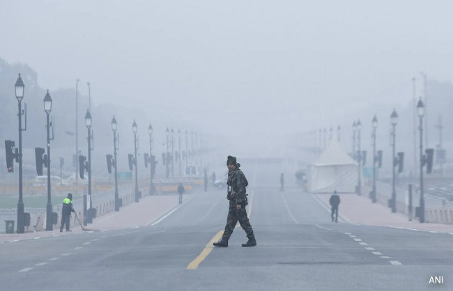
While eastern and southern India prepare for rain and storm-related disruptions, northern India is witnessing a different weather pattern. Temperatures are gradually dropping, indicating the increasing influence of winter across several northern states. The meteorological department has forecast dense fog conditions in Delhi, Haryana, Chandigarh and Punjab until Sunday. Reduced visibility during early morning and night hours could affect road, rail and air transportation.
With Cyclone Akvan intensifying over the Bay of Bengal, weather conditions across several states are expected to remain unsettled over the coming days. From red alerts along the Andhra Pradesh and Odisha coasts to heavy rainfall in Gangetic West Bengal and dense fog in northern India, the country is preparing for multiple weather challenges. Authorities have urged people to remain updated with official weather bulletins and avoid unnecessary travel during adverse weather conditions.
You might also like!